Share this with your friends


+18634500602
Hometrust Real Estate and Property Management
72nd Terrace, Seminole, FL 33776
- $2,595,000




- List Price
- $2,595,000
- Status
- Active
- Days on Market
- 1
- MLS#
- TB8569600
- Lot Size
- 227,431
- Acres
- 5.22
- Total Acreage
- 5 to less than 10
- Legal Subdivision Name
- Acreage
- MLS Area Major
- Seminole/Largo
Property Description
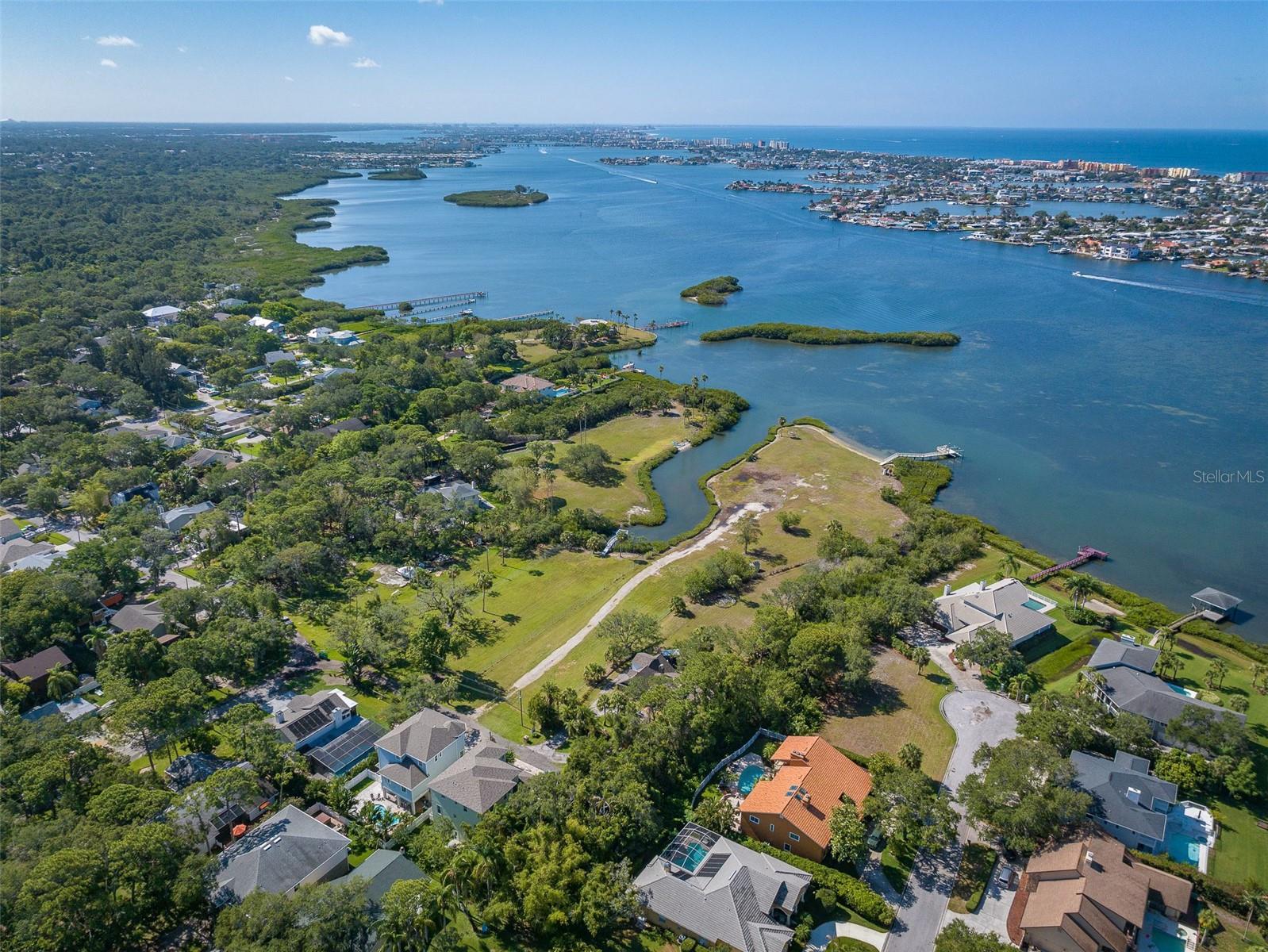
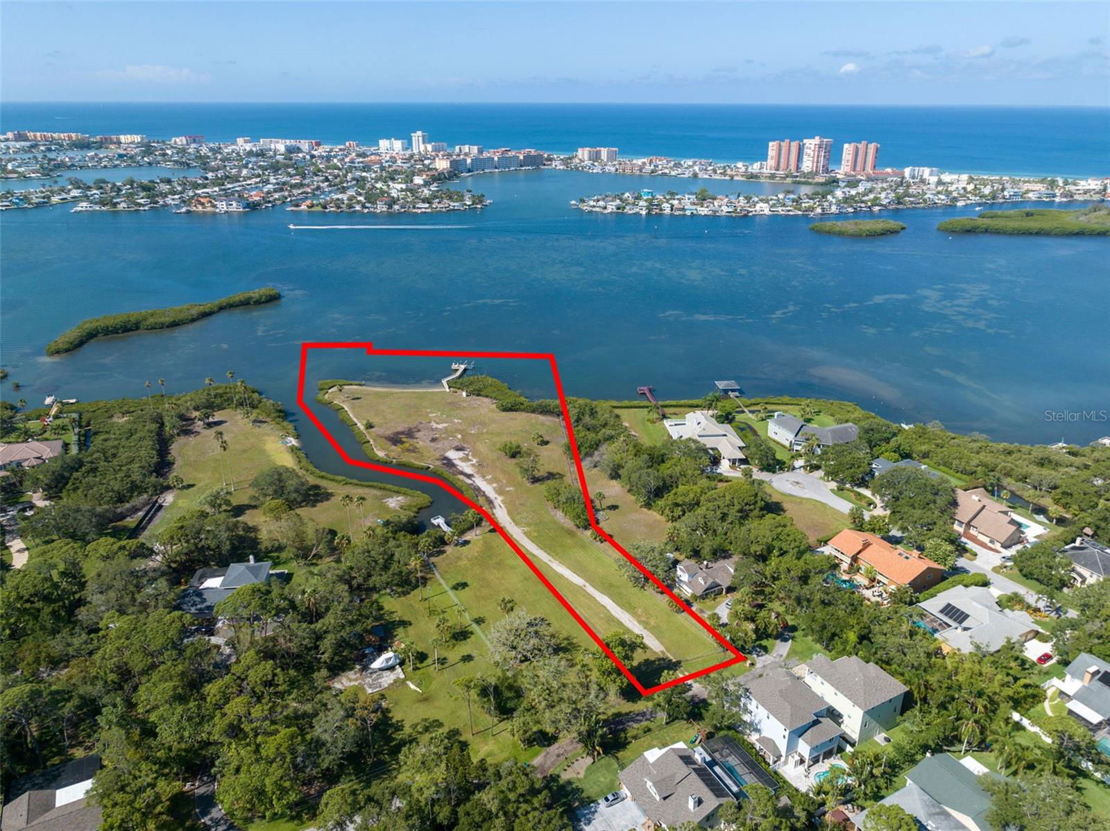
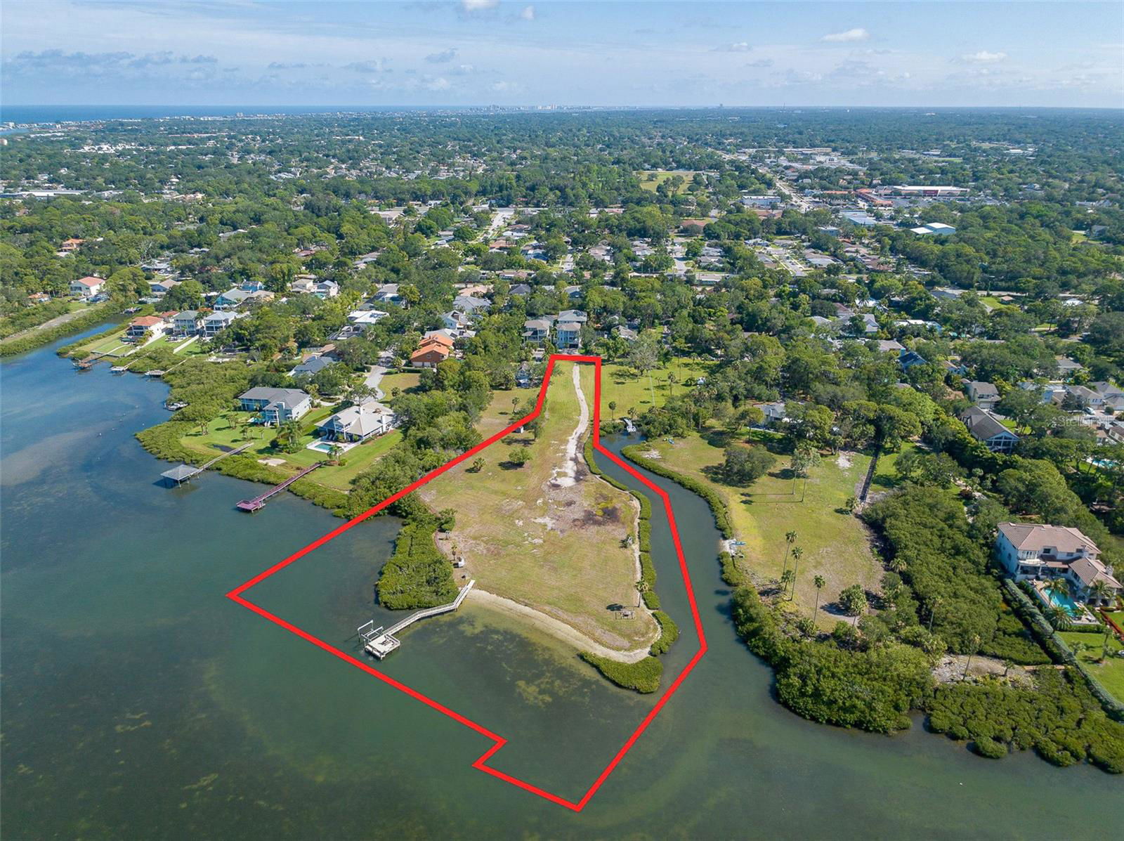
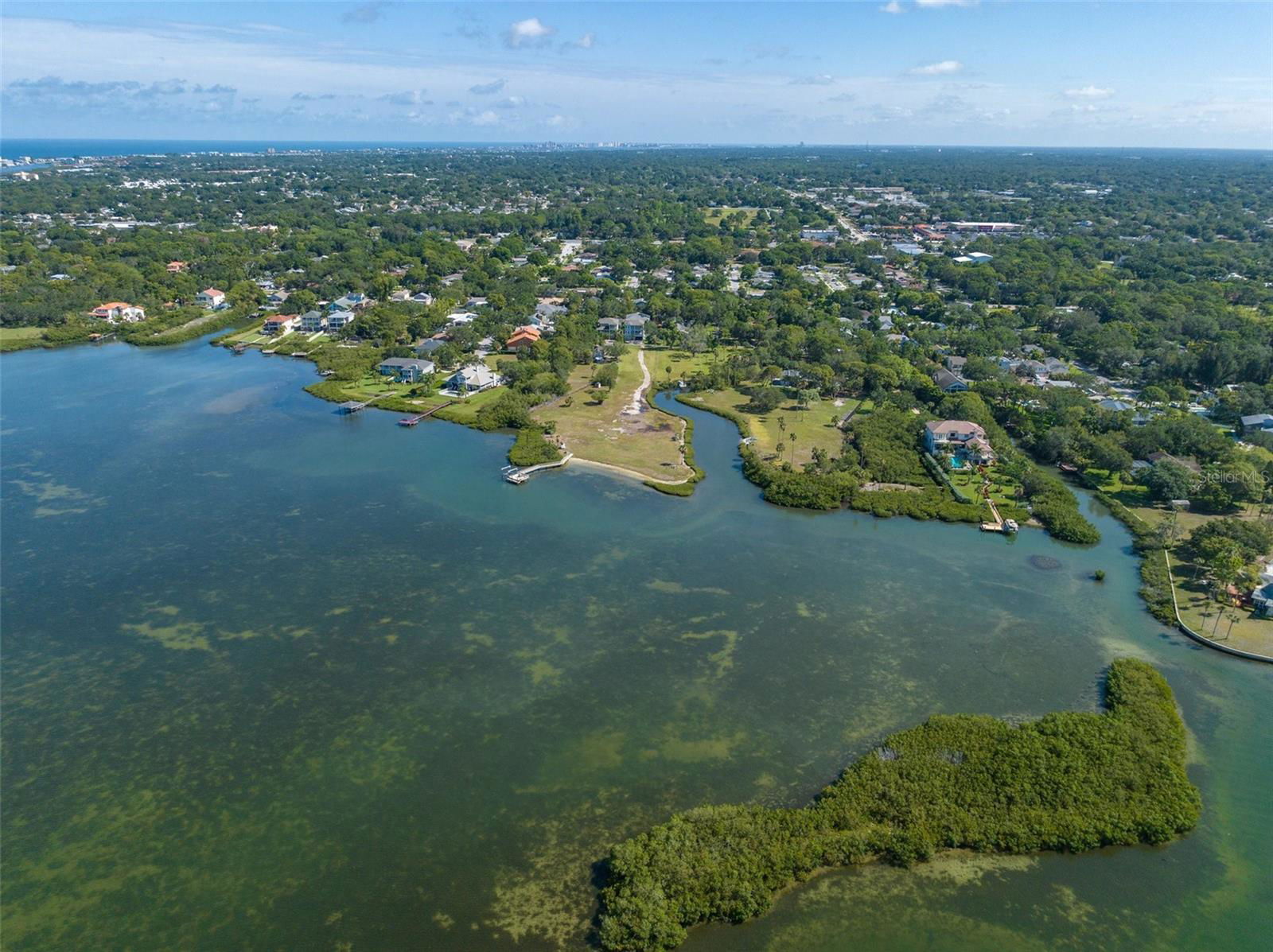
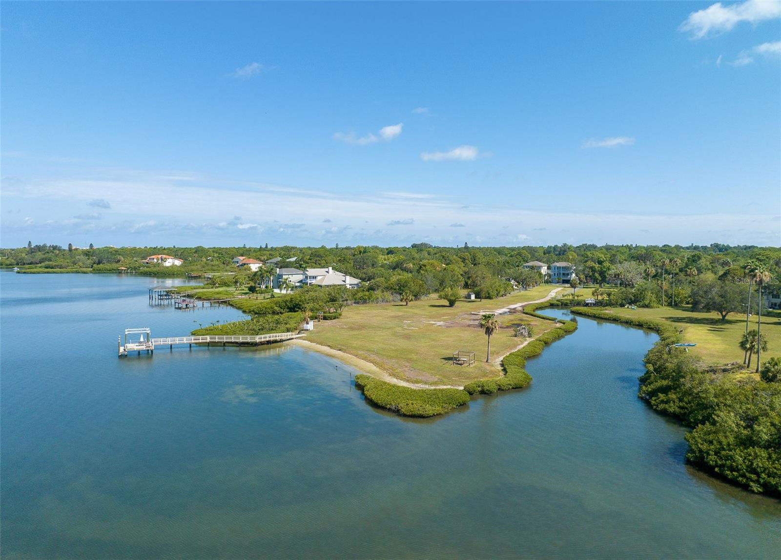
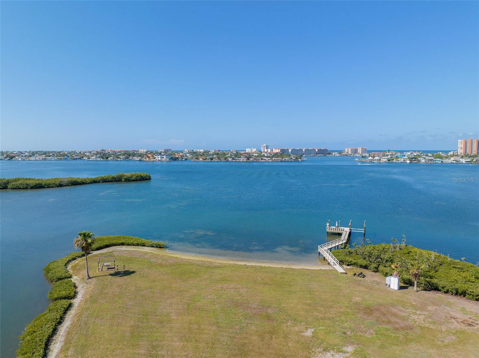
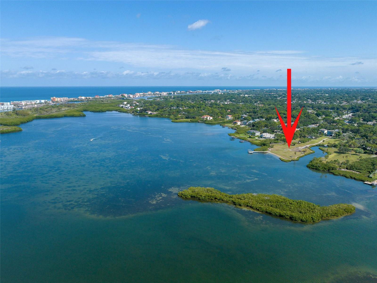
EXTRAORDINARY WATERFRONT PENINSULA ON BOCA CIEGA BAY. Discover a rare opportunity to build a custom luxury estate on private, cleared mainland waterfront in Seminole's sought-after Harbor View community. Accessed by a long, private entry drive off a quiet no-through street, this secluded headland offers unmatched privacy, bordered by the open waters of Boca Ciega Bay and the Intracoastal Waterway on one side and a tranquil, mangrove-lined tidal cove on the other. Cleared, level, and ready for your custom single-family residence with no HOA restrictions, the property features panoramic water views across the bay to the barrier islands, its own private beach shoreline, and a dock equipped with a 13,000 lb boat lift accommodating up to a 30-foot bay or center-console vessel. Launch kayaks directly from your shoreline, fish the grass flats, or watch dolphins and manatees from your backyard. Ideally positioned on the mainland just minutes from sparkling Gulf beaches, shopping and dining, downtown St. Petersburg, and Tampa International Airport.
Additional Information
- Taxes
- $24133
- Location
- In County, Level, Oversized Lot, Private, Street Dead-End
- Community Features
- No Deed Restriction
- Zoning
- R-1
- Utilities
- BB/HS Internet Available, Cable Available, Electricity Available, Phone Available, Public, Sewer Available, Water Available
- Pool
- No Pool
- Elementary School
- Bauder Elementary-Pn
- Middle School
- Seminole Middle-Pn
- High School
- Seminole High-PN
- Water Name
- Intracoastal-Boca Ciega Bay
- Water Extras
- Fishing Pier
- Water View
- Bay/Harbor - Full, Canal, Gulf/Ocean - Partial, Intracoastal Waterway
- Water Access
- Bay/Harbor, Canal - Saltwater, Intracoastal Waterway
- Water Frontage
- Canal - Saltwater, Intracoastal Waterway
- Flood Zone Code
- AE
- Parcel ID
- 29-30-15-00000-340-0100
- Legal Description
- PART OF SE 1/4 OF SW 1/4 OF SEC 29-30-15 & PART OF NE 1/4 OF NW 1/4 OF SEC 32-30-15 ALL DESC BEG NW COR OF LOT 23 OF HARBOR VIEW NO. 2 TH S88D50'28"E 80FT TH S00D37'09"W 363FT TH S29D20'44"E 188.02FT TH S00D37'09"W 210.3FT TH S23D45'W 351.94FT TH N66 D15'W 91.5FT TH N23D45'E 59.72FT TH N66D15'W 272.47FT TH N23D45'E 701.57FT TH N00D37'09"E 217.52FT TO POB CONT 5.23AC(C)
Listing courtesy of CHARLES RUTENBERG REALTY INC. 866-580-6402
How much is your home worth?
...get instant property value now!
Mortgage Calculator
StellarMLS is the source of this information via Internet Data Exchange Program. All listing information is deemed reliable but not guaranteed and should be independently verified through personal inspection by appropriate professionals. Listings displayed on this website may be subject to prior sale or removal from sale. Availability of any listing should always be independently verified. Listing information is provided for consumer personal, non-commercial use, solely to identify potential properties for potential purchase. All other use is strictly prohibited and may violate relevant federal and state law. Data last updated on